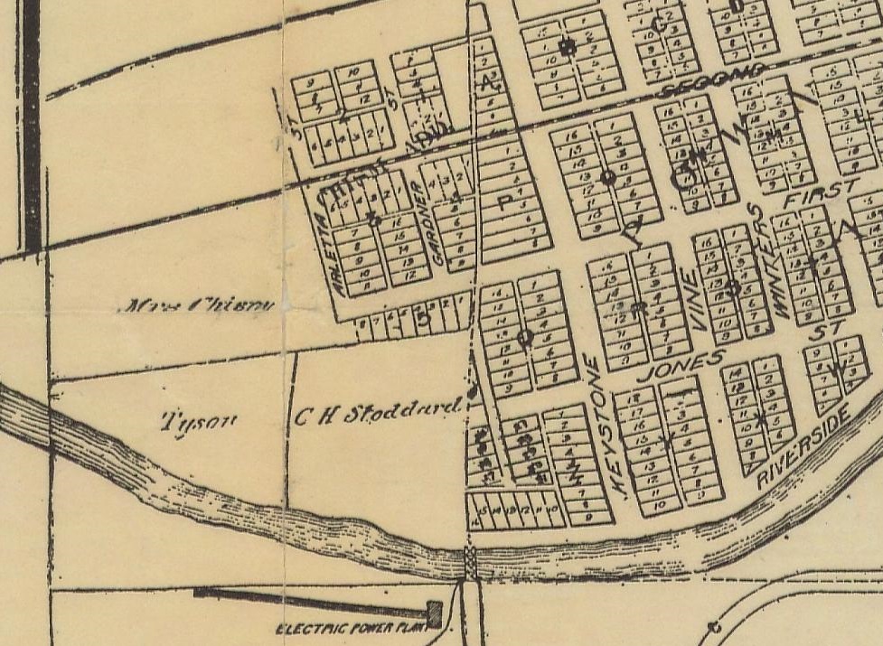
A detail from a 1907 map of Reno shows the extent of the ranch property at the time, labeled "Mrs. Chism," with the Chism Addition that the family had carved out of its land in 1904 located just to its right (east). The wide wavy line toward the bottom is the Truckee River. | Date: 1907 | Source: Philip GalbraithDownload Original File